CedarField
An agricultural intelligence platform in development, using satellite data and bilingual tools to help farmers in Lebanon understand their fields.
Overview
- Role
- Creator / Developer
- Status
- In Development
- Technology
- Next.jsReactTypeScriptConvexClerkMapboxCopernicus SentinelOpen-MeteoAnthropic API
- Year
- 2026
- Initial focus
- Lebanon
- Languages
- Arabic and English
- Stage
- Working prototype
The Project
CedarField is an agricultural intelligence project focused on Lebanon, with a longer-term ambition to serve the wider Middle East and North Africa. It brings satellite observations, field mapping, and accessible explanations into a web application available in Arabic and English.
I am developing CedarField to explore how environmental data can become useful at the level of an individual field. The aim is to help farmers follow changes in their crops and identify questions worth investigating on the ground.
The Problem
A satellite image can reveal patterns across a landscape, but turning those patterns into useful information requires several steps. The relevant field must be identified, usable observations selected, and changes interpreted in context.
For a farmer, the useful question is often specific: has this field changed since the last observation, and does that change deserve attention? CedarField is built around making that information easier to find and understand, through a familiar map and concise explanations.
How It Works
Users draw a field boundary on a map and record what is growing there. The application organizes satellite observations around that boundary, keeping the readings connected to a named field and its crop information.
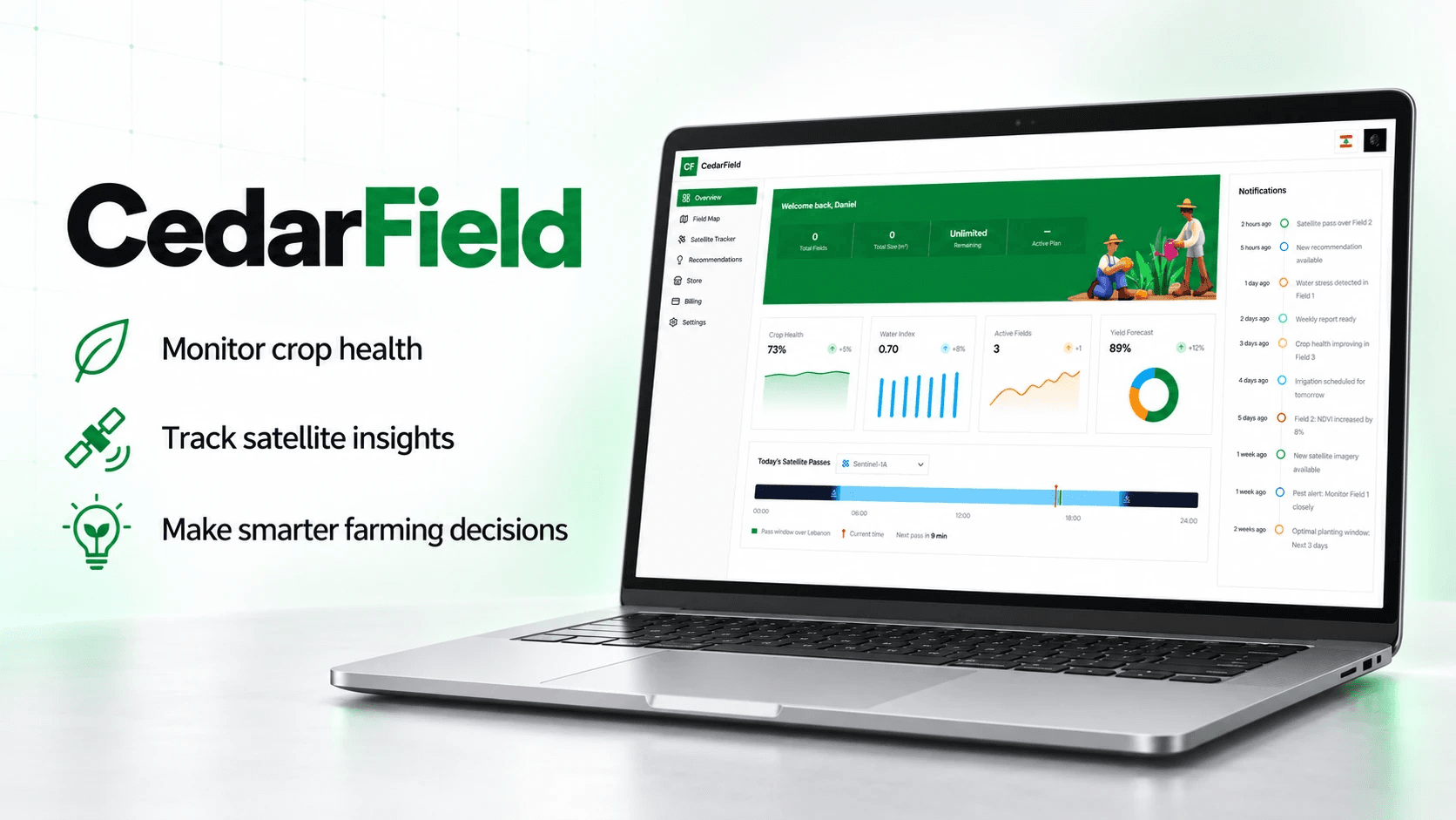
The data pipeline processes Copernicus Sentinel imagery into indicators of vegetation and canopy moisture. The dashboard presents index readings, trend charts, image previews, and a feed of observations generated by the recommendation engine.
Historical imagery and weather-data integrations extend the context beyond the latest observation. The implemented data layer supports historical backfilling and records cloud coverage and usable-pixel information, helping distinguish a change in the field from a weak observation.
From Data to Explanation
CedarField separates the calculation of indicators from the wording used to explain them. A rule engine evaluates satellite readings and produces structured findings. An AI language layer then turns those findings into short recommendations in English and Arabic, with predefined text available when the AI service cannot respond.
This gives the system a traceable path from a reading to its explanation. The language model receives the relevant findings and is instructed to work from them, while the rules determine which observations appear.
The current recommendation engine is an early prototype. Its outputs are prompts for further inspection, rather than a diagnosis of a crop problem or a complete irrigation plan. Developing more detailed, locally informed agronomic models is a central part of the remaining work.
Designed for Lebanon
Lebanon is the starting point for both the product and its interface. Field management includes Lebanese administrative locations, while Arabic and English are supported across the application, including right-to-left layouts.
The wider product plan considers farmers, agricultural cooperatives, and organizations supporting agricultural development. These groups need different levels of detail, but share a need to connect environmental observations with a particular place and growing season.
Language is part of that design work. An indicator needs more than a translated acronym: it needs an explanation of what the reader is looking at and why it may matter. CedarField combines maps, charts, and bilingual text to make that interpretation more accessible.
My Role
My work spans the product concept, application development, interface design, and the integration of external data services. It includes the field-mapping experience, the satellite-data workflow, and the way results are presented to users.
The project also involves defining a realistic path from prototype to service. This means separating working capabilities from future features and identifying where software development needs to be supported by agronomic expertise and observations from real fields.
CedarField connects my interests in technology, research, and development in Lebanon. It is an opportunity to build a practical digital product around environmental information while paying attention to the people expected to use it.
Design and Development
CedarField is built with Next.js, React, and TypeScript. Convex handles application data and scheduled processing, Clerk provides authentication, and Mapbox supports field mapping. The interface uses Tailwind CSS and shadcn/ui.
Copernicus services supply the satellite-processing pipeline. Weather integration uses Open-Meteo forecast and historical data, while the recommendation text layer uses the Anthropic API. Processing budgets and refresh policies are part of the data infrastructure, so the application can manage the cost of monitoring multiple fields.
A separate satellite-tracking interface visualizes spacecraft and predicted passes. This complements the product's presentation of satellite data; the agricultural analysis itself comes from processed imagery.
Current Stage
CedarField is a working prototype under active development. Field management, bilingual dashboards, satellite indicators, historical-data processing, and an initial recommendation system are implemented. Their existence does not yet establish a fully validated agricultural service.
The roadmap includes crop-specific models, weather-informed irrigation guidance, field-zone analysis, messaging delivery, and seasonal reports. Yield forecasting requires calibration against harvest data and remains future work. The next stage is to strengthen the agricultural interpretation and validate it with relevant expertise before a wider launch.